The River Danube and its Course Through Europe
HOME | Articles | River Danube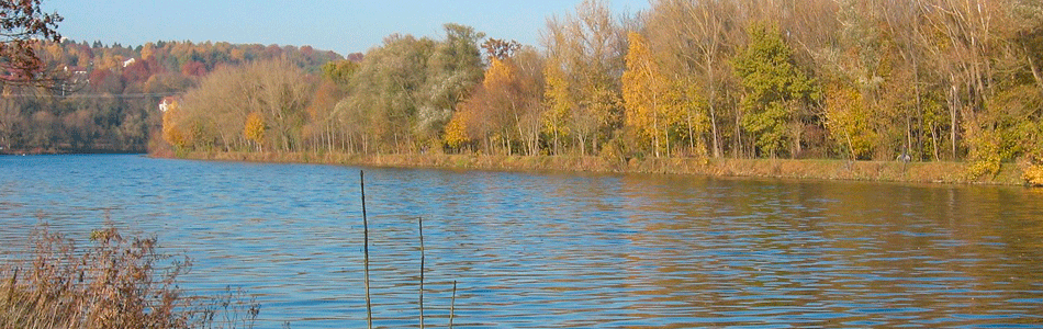
The River Danube in Europe
The Danube is the second longest river in Europe, but it carries little traffic for its size and is not by any means the second most important. It flows for more than 1,725 miles through seven countries until it reaches the Black Sea. A well known song calls it 'The Blue Danube', but for long sections it is bordered by uninteresting lands and its waters are dull and muddy. One of its great handicaps for trade is that it flows in the wrong direction - from west to east - away from the wealthy western industrial lands. Its mouth, in the Black Sea, is also far away from the busiest shipping and ocean routes.
The Danube rises in Germany amidst the densely wooded hills of the Black Forest, not far from the upper Rhine, and flows eastwards towards Austria. In times of drought the river disappears underground near its source. Stranger still, the water that vanishes does not afterwards reach the lower Danube but flows underground to Lake Constance, which is partly in Germany and partly in Switzerland, and so joins the Rhine; it then goes on to the North Sea. At Passau, near the Austrian frontier, the Danube receives its tributary the Inn, which brings much water from the Alps. The river valley narrows very much at this point as the Alps on one side approach the Bohemian mountains on the other.
From Passau to Vienna is the most beautiful section of the whole river. High wooded hills, sometimes crowned with ancient castles, look down on the swiftly flowing river. In summer, river cruise ships crowded with holidaymakers ply up and down and the speed of the river is shown by the fact that the up-river trip takes more than twice as long as the down-river journey. One of the old castles, at Durnstein, was the prison in which the Prince of Austria locked up Richard the Lionheart, King of England.
The great city of Vienna stands where the river leaves the hills. Its importance is largely due to the road and railway routes that come from north and south to cross the river at this point. The gap formed by the Danube has been of great importance in history, for time after time eastern invaders - Magyars, Tartars and Turks - have been stopped here. The Duke of Marlborough and Napoleon both fought to gain control of it at different times.
Once clear of the mountains, the Danube turns east and then turns abruptly south past Budapest, the Hungarian capital. Its course now lies across the open plains of Hungary. Very cold winters and hot, dry summers prevent the growth of trees and the country is a rather dry steppe land, or treeless plain, at one time used only for pasture when fine horsemen tended herds of almost wild horses and cattle, whilst shepherds on foot followed their flocks from well to well.
Here the Danube no longer hurries along, sparkling in the sunshine, but moves very slowly over the almost level land. Often it breaks up into three or four channels, its banks being marshy and nearly everywhere lined with tall reeds. In winter it freezes and the spring thaw frequently causes floods. Few people therefore lived near the river. In some of the bordering lands the soil is so dry and light that the wind blows it up into long sand dunes.
In this section of its course the Danube receives some of its most important tributaries, from the Alps and from the great curve of the Carpathian Mountains. As these smaller rivers approach the Danube they all have the same marshy reed-lined valleys. Away from the rivers, grain and sugar beet are grown, and such crops, together with wool from the sheep, formed the cargoes of boats travelling upstream towards Vienna.
Near the junction of the Sava and the Danube and on a hill overlooking the rivers stands a third capital city - Belgrade. At this point the river makes one more abrupt change in its course and turns eastward. Before long the hills close in on the river again and this time an even narrower valley is formed than that above Vienna. The gorge is so deep and narrow that it is impossible to build either road or railway alongside the river. The flow of the river quickens here too and makes navigation more difficult. The eastern end of the gorge is known as the Iron Gate.
Between the Iron Gate and the Black Sea the Danube is bordered by swamps and shallow pools which stretch for four of five miles on each bank. These make it very difficult to build bridges, and in a distance of nearly 700 miles only one railway crossed the river. This part of the river is thus a great barrier between the lands of the north and south. It is not surprising, therefore, that it forms the boundary between Romania and Bulgaria for about 400 miles. South of Cernavoda in Romania the river turns north for about 100 miles and then east to the Black Sea, which it enters through a vast delta.
With its tributaries, the Danube drains more than 300,000 square miles of country, most of which is in the very heart of Europe. For much of its course it can be navigated by ships and in many places its current is slow enough to allow river cruise ships and long strings of barges to be towed. In its upper course it passes near such industrial lands as southern Germany and the Czech Republic, while throughout its lower course it flows through agricultural lands.
Reproduced and/or adapted for educational purposes.
UK-Warehouse | Travel and Holidays | Caister Caravan Holidays
Designated trademarks, logos, brands and images are the copyright and/or property of their respective owners.
Copyright © 2004-2022 All rights reserved.
You are here: